
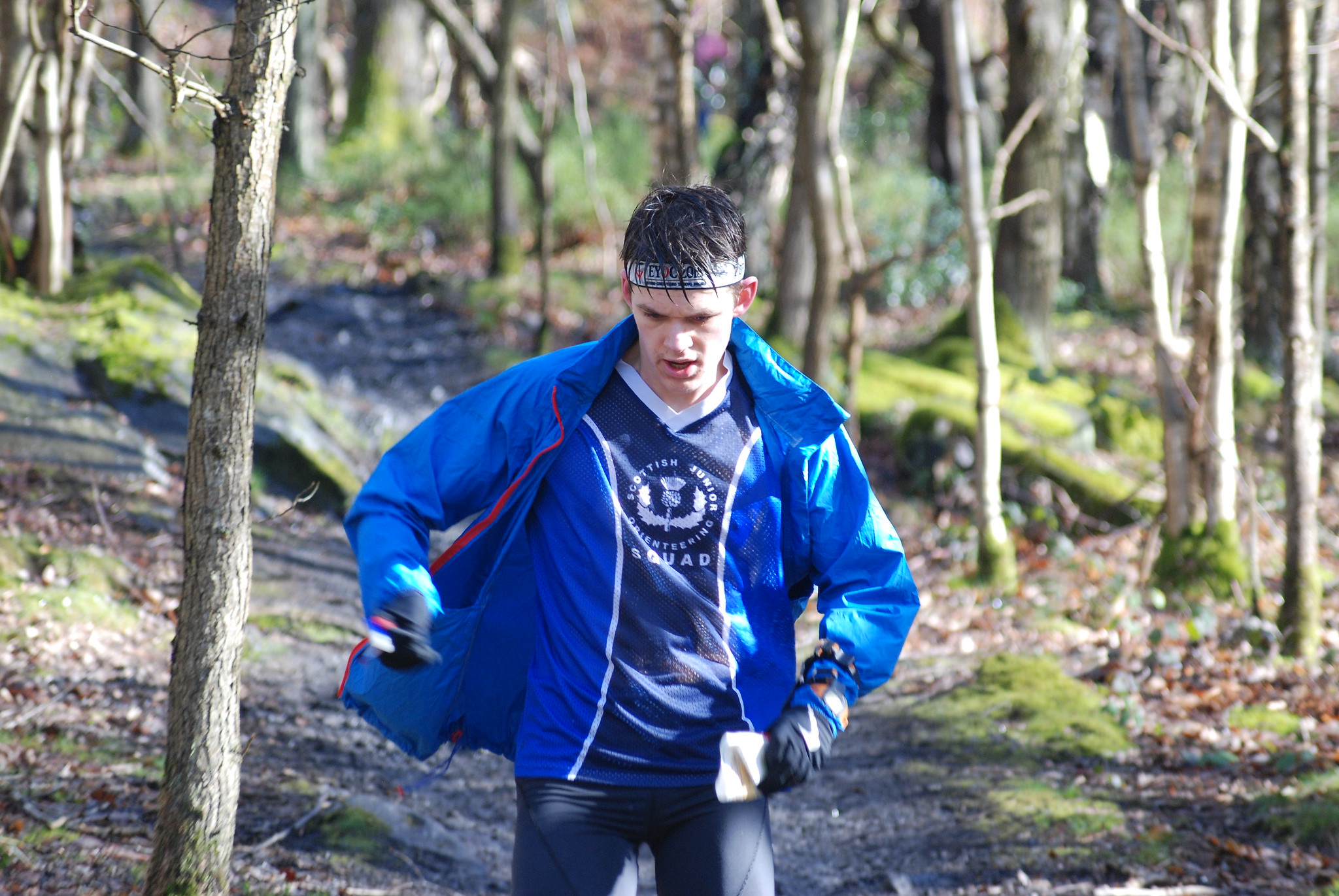
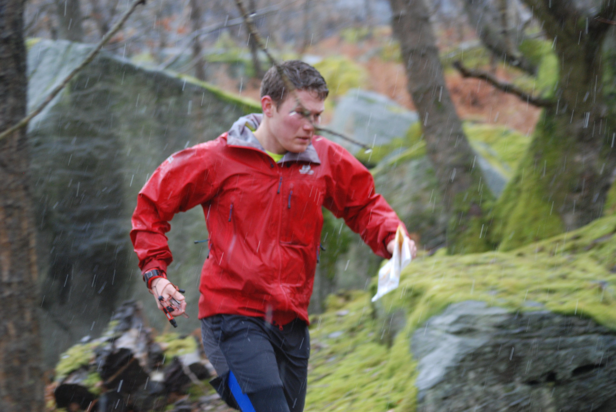
This section explains the most basic elements of orienteering technique that you need to have working like clock work, as a basis for all your orienteering. There are links below to 4 series of videos that show how to use these ideas in practice.
Basic Navigation Routine
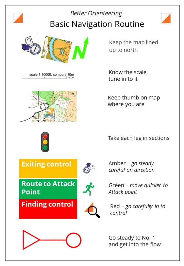
Here is a visual summary of a Basic Navigation Routine. This is what you need to be able to do to orienteer reliably. You must master this or orienteering will always seem a mystery and you will keep getting needlessly lost!
You can download the summary below and it is discussed in more detail as you read on further down this page under the section Basic Navigation Routine in More Detail. It can be helpful to have a copy of this summary on a smartphone or printed out, to refer to before competing in races as a reminder of the routine.


Plan, Picture, Direction
There are various ways you can summarise these skills so you can remember them when orienteering. Plan, Picture, Direction is the model used across Better Orienteering. It gives an easy way to integrate your skills learning into steps to remember for each leg of a course. (This model is discussed in more detail in the Intermediate and Advanced sections).

To use Plan, Picture, Direction, as a minimum you need to do the following for each leg of the course:
- Make a Plan including a route and Attack point,
- Picture what you will see on route and at the control,
- Use map and compass to maintain accurate Direction,
- Keep matching the terrain you are Seeing to the map as you go.
Using Plan, Picture, Direction – a simple example
Think of navigating in some simple steps
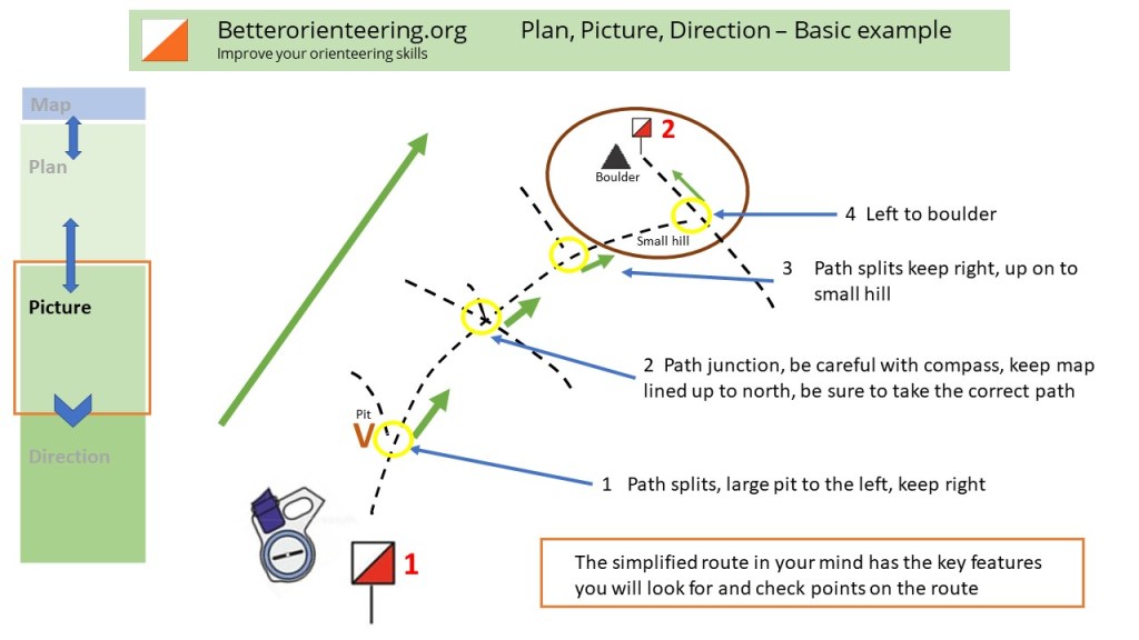
Here is an example – there is a map extract and diagram below.
Plan a route on the map. As a beginner try to follow line features like paths or a fence.
Picture in your mind what you will see on the way.
Then use the compass to keep the map lined up to north and navigate in the right Direction to the control.
Move your thumb along the map as you progress
Remember to turn the map when you turn corners and always keep it lined up to north.
Check off, or note, features as you pass them to help keep track of where you are, such as for example, passing a junction with another path or track, or maybe noting where a stream crosses the path.
Estimate how far you have to go and keep track of how far you have been.
Plan, Picture, Direction – 3 simple steps!

Here is another example of Plan, Picture, Direction linked to a video by O-Ringen TV (thanks to Simon Eklov for permission to include the example).
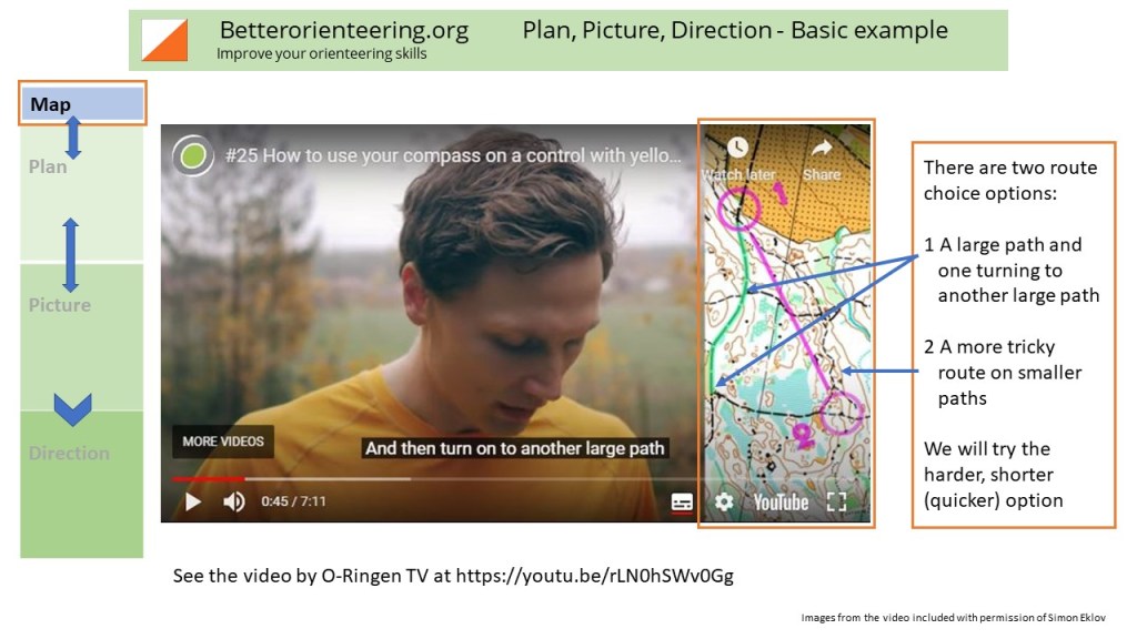

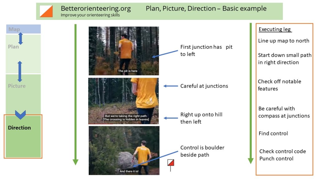
The video is in Swedish with English sub-titles but the don’t be put off it you don’t speak Swedish. Orienteering is a visual task, the words are much less important than seeing what to do! That is the case in all stages of orienteering skills development – it is about seeing what to do from the map and compass. Viktor runs the leg showing what you need to do.
Plan Picture Direction and all the other key graphics on Better Orienteering are included in the Better Orienteering Summary
(These skills are also expanded upon in the Skills Tool Kit under the Intermediate Skills section)
Basic Navigation Routine in more detail
Remember the basics, have a firm navigation routine
The visual summary at the start of this section captures the main elements of Basic Navigation Routine that you can use as the foundation of all your navigation.
You must develop a rock solid Basic Navigation Routine. If you don’t, it will hold you back for years until you get it sorted. These concepts are now discussed one by one.
Fold the map
Always keep the map oriented to north all the time. Track where you are with your thumb or thumb compass.
Most thumb compasses work on your left hand. If you are right-handed, it can be helpful to hold the map in your left hand with the thumb compass. It may sound odd, but for many people it literally helps you switch on the part of your brain that works on spatial tasks. It dissociates map reading from tasks we normally do with our dominant hand such as writing, which helps also in spatial thinking because a map is not a book, it is a simplified picture of reality.
Try this SLOW video, Setting the Map.
The video link below takes you to the YouTube playlist for the Get Up To Speed videos. Select the video 2/9 Setting the Map from the playlist. (Click on the 3 bars top right of the video to see playlist)
Break every leg into 3 parts
Exiting control (in the right direction)
Route to Attack Point
Finding control
When planning your route it can help to identify your Attack Point first, then plan a route to the Attack Point. The Attack Point needs to be something you can find easily from where you can go more carefully into the control.

Traffic Lights
You can also think about sections of each leg in terms of Traffic Lights, red, amber, green. You go quickest in the green or easier parts of the leg, then more carefully in an amber section and finally very carefully on the red or trickier bits such as into the control. This idea works well for some people. Personally I found it very helpful at one point in my orienteering development to identify parts of legs in that way, but as my technique improved it stopped being such a helpful way to classify many legs I was facing. The key takeaway is that you need to think of legs in sections and tackle them appropriately in terms of navigation skills and speed.
For very short legs between controls that are close together, exiting the control, finding an Attack Point and fine navigation into the next control can seem less distinct than for longer legs where they are much more clearly separate stages of getting to the next control.
Go steady to number 1 and get into the flow
Orienteering is spatial thinking. You must let your mind get into the zone and tune into the way of thinking it needs to orienteer. Psychologists call this Flow, where there is harmony between physical effort and thought processes. Flow is both a state of mind and the result of building up the skills base to draw on to implement in the navigation challenges of orienteering. As you go to the first control try to tune in your mind to map reading and in particular tune in your sense of the scale of the map and how you are experiencing it in this terrain.
1:10,000 means 1 cm on the map is 100 meters on the ground. 1:7500 means 1 cm is 75 metres. However, 100 metres will feel different in different terrain e.g flat fast parkland vs steep, rough Scottish forest.
Tuning in to get good Flow means tuning out of other things. Thinking about something else will mess up your run.
Give yourself permission to let everything else go and focus just on orienteering. As a bonus, orienteering will clear your mind so you will think more clearly about whatever else has been on your mind later.
Orienteering is about navigation much more than it is about running
I have managed to win when injured, by walking briskly round a Green course losing no time and making no mistakes, then a few weeks later I have run and had a worse result. If you are a fit runner and shadow a top-level orienteer in your age class most people are impressed how slowly they are running overall compared to say a cross-country race. It is simply not possible to run at maximum pace and think at the same time. However, more fitness buys you a clearer head at any given running speed. As fitness improves then as a rule of thumb, about half the possible benefit goes on thinking clearer at a quicker speed and half on actually going faster.
Stay in constant contact with the map and compass
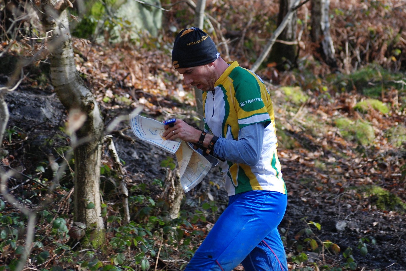
One of the most common problems for beginners is not looking at the map enough. You need to keep continually looking at it, updating where you are and noticing new relevant information about where you now are.
One of the biggest improvements many people can make is simply to look at the map more often.
At the same time as maintaining good map contact your compass is your friend. It is essential to maximise what it can add to your navigation. When you turn tight corners especially at a control, it can be hard to turn your mental map round in your head fast enough to not mis-orientate and head off in the wrong direction. The compass does this faster and more reliably than you, so use it and believe it.
Try this SLOW video on compass use.
The video link below takes you to the YouTube playlist for the Get Up To Speed videos. Select the video 3/9 Using the Compass from the playlist.
When you become unsure of where you are, relocate yourself straight away
Rushing on and hoping it will work out will go wrong. Orienteering is called orienteering because it derives from the Swedish orientering, which can be translated as orientating yourself. You will need to update your understanding of where you are, that is orientate yourself, literally hundreds of times in a course. As you wander off line or make a small mistake, because you are staying in constant contact with the map you can catch the problem before it snowballs out of control and get back on line quickly. Relocation is a normal part of orienteering, all the time, for everyone
What do you do when it goes wrong?
STOP! – and work out where you are. Don’t keep going or go round in circles, you will loose more time than if you work out where you are.
Have a Relocation Strategy to help you find your location again. The next diagram sums up how people tend to be thinking at the level of Basic Navigation.

This table sums up what you can do to relocate.

Only run as fast as you can think
Once you have learnt basic navigation, orienteering is about managing your thinking under oxygen debt. You need to feel the level of clarity in your mind and how it is performing on the navigation tasks of a leg and manage your effort accordingly. If you aim to only run as fast as you can think, then you need to learn to be sensitive to how you are thinking under oxygen debt and be honest about when you need to slow to let your head clear. If your level of navigation skill requires you to drop to a walk to avoid a big error, do it. It will save you more time in the long run than charging on into errors.
Think of it
as two sides to an equation. You vs the
navigation.
| You Your fitness, how well you feel, how much sleep you have had, your level of navigational skill and the amount of recent practice at orienteering, how far you are into the course | The navigation The difficulty of the terrain, the complexity of the leg you are running, how well you know this type of terrain, where you are in the leg |
Thus, you need to match your physical effort to the demands of the navigation so that your head is clear enough to navigate well. Anticipating how your level of effort will affect navigation means that you will plan in the literal breathing space in a leg to get the navigation right. For example, 5 seconds gained running up a steep hill is a poor trade-off compared to the additional time reading the map more slowly at the top or getting lost. A lot of high-level orienteers always walk briskly up steep hills staying in contact with the map as a measure of their oxygen debt.
Don’t simply import your navigation techniques from other scenarios
The approach
to navigation you learnt in the Army or the Scouts, or mountaineering will need
to be modified to succeed at orienteering.
In the infantry, where your life and others are at stake, then slow, deliberate and precise progress is essential. In contrast, when orienteering you can afford to simplify large sections of some legs and move through the terrain to a catching feature at speed with confidence. Orienteering, the only risk you face is getting off line or lost.
When mountaineering, safety is paramount and conservative route choices that are guaranteed to be executed reliably are essential. Orienteering needs a different approach where you consider the risks in a different framework, where getting off line just means relocating not risking your life.
Map reading from Road Atlas or Sat Nav may have some helpful analogies to bear in mind orienteering, but on foot you can go anywhere, and YOU must do the simplification and zooming in and out of detail in your head.
Skills Matrix
The Better Orienteering Skills Matrix gives an overview of what skills are essential for a reliable Basic Navigation Routine. You can also see skills you will be developing next.

Reinforce the basics
If you haven’t watched the 10 videos on the basics of orienteering from the Irish Orienteering Association, then they are worth viewing now. They will give you a good overview of where you start with navigation.
If as you read this, it becomes clear that it has started too far down the orienteering learning curve for you, then watch some of the introductory videos in this section and then come back to these skills discussions when you have tried a few more orienteering events.
Basic navigation mistakes
The section Race Analysis has a list of common errors structured according to the skill levels on Better Orienteering under the heading Optimising your performance – a catalogue of errors. If you are aware of some of the most common mistakes it can help you both avoid them in the first place and also relocate more quickly when you make such errors. As your orienteering experience and skills grow you will understand more of what you can improve and become better at understanding what went wrong. The crucial thing is to recognise that everyone makes mistakes all the time, the aim is to minimise them as much as possible.
Start joining your skills together – O-Ringen School videos
The O-Ringen is a 5 day orienteering competition in Sweden every summer and is the largest multi-day orienteering event each year world-wide. O-Ringen TV have produced a series of introductions to skills for people early in their orienteering experience – in Swedish with English sub-titles, called O-Ringenskolan – O-Ringen school.
Well worth watching.
The start of the playlist is here at the episode on Map Contact:
Link to playlist page: O-Ringen School
Some of the videos are about basics. Other ones demonstrate more Intermediate level skills , for example: Sort away details on the map, which is about simplification, and Testing route choices, which we come back to in the Intermediate section.
The series includes the following episodes. (The episodes are part of a larger series of videos, you can also locate them by title and episode number).

Some recommendations for what to look at next
The next section of this page looks at some resources you can use to expand your knowledge of the basics of orienteering. You can use these resources as and when they seem helpful. For example, if you find you are having difficulty with contours then you can find help here in several places on how to understand contours. Or it could be more detail on how to use a compass.
Top recommendation
Göran Andersson, from Sweden, has produced two excellent introductions to orienteering, one aimed at adults, the other at school children. They give a good overview of orienteering and map reading and are richly illustrated. There is helpful material for orienteers of all ages in both.
see Göran’s website for details of how to order copies of either book http://www.byorienteering.se/
Göran Andersson (2017) ‘Cool, Awesome, Educational – Orienteering in Simple English’
Göran Anderson (2020) ‘Cool, Awesome, Educational Orienteering at school ages 6-15′
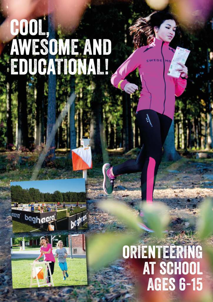
Here are some pages from the 2020 book Cool, Awesome and Educational Orienteering at school ages 6-15, (Reproduced with kind permission of Göran Andersson). They illustrate some of the practical exercises and explanations you can work through. You can find the answers and much more in the book by following the link above.


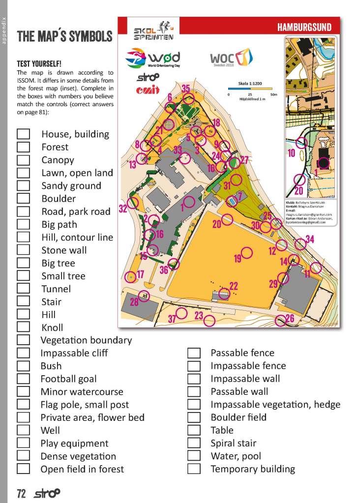

Both books by Göran Andersson are free to view on Issuu.

Know your sport leaflets, BKO
Understanding contours is one of the trickiest things for people starting orienteering. Here is another overview of how to understand contours Up and Down: Using contours by David Jukes of BKO.

This leaflet So What is Orienteering? gives an index to all the Know Your Sport Leaflets
The list of leaflets by David Jukes can be found here: Know Your Sport Leaflets
http://www.bko.org.uk/what-is-orienteering
Orienteering Australia map reading training exercises
Orienteering Australia has some map reading training exercises in their Coaching Tips section (included here by kind permission of Orienteering Australia ACT). You can attempt a series of exercises and tasks to develop your understanding of map reading. Each topic has a free download to work through.

| Coaching tips on Map Reading – Orienteering ACT: 1 About the coaching tips 2 Contents page 3 How to use the guide 4 Contours 5 Orientating the map 6 Man-made linear features 7 Introduction to vegetation 8 Naming contour features 9 Water features 10 Rock on! Identifying rock features 11 Earthworks 12 More Man-made features 13 Variations on vegetation 14 Contours #2 15 On course. Following the course on the map |
Check that you know your control descriptions and symbols
There are various phone Apps and online games to help you learn them. Try Octavian Droobers free online quiz.

Maprunner Control Description Quiz
Here is another way to practice and develop your knowledge of control descriptions with an interactive quiz.
Maprunner Control Description Quiz
Skilling Up
Richard Sansbury of Quantock Orienteers has linked many useful discussions on skills in Skilling Up.
https://www.quantockorienteers.co.uk/info/training/skills-matrix
A range of basic questions about orienteering navigation are covered as well more advanced skills that Better Orienteering comes to in later sections. You may find helpful information on for example, Taking bearings, or Decision points in a leg between controls.

Visit Quantock Orienteers Skilling Up, to access any of these guides
Interactive fun with contours
Graham Relf has made a fun program to play with contours. You simply click the link and start clicking on the screen to create shapes. You then click on ‘Go to Scene’ and view what you have created. You can add to contours and drag them to change their shapes. The program runs entirely within the browser window. It can be useful for demonstrating how contours work.

It is easiest to start clicking to create contours near the centre of the screen. The red circle with an arrow on it shows the direction of view in Scene mode.
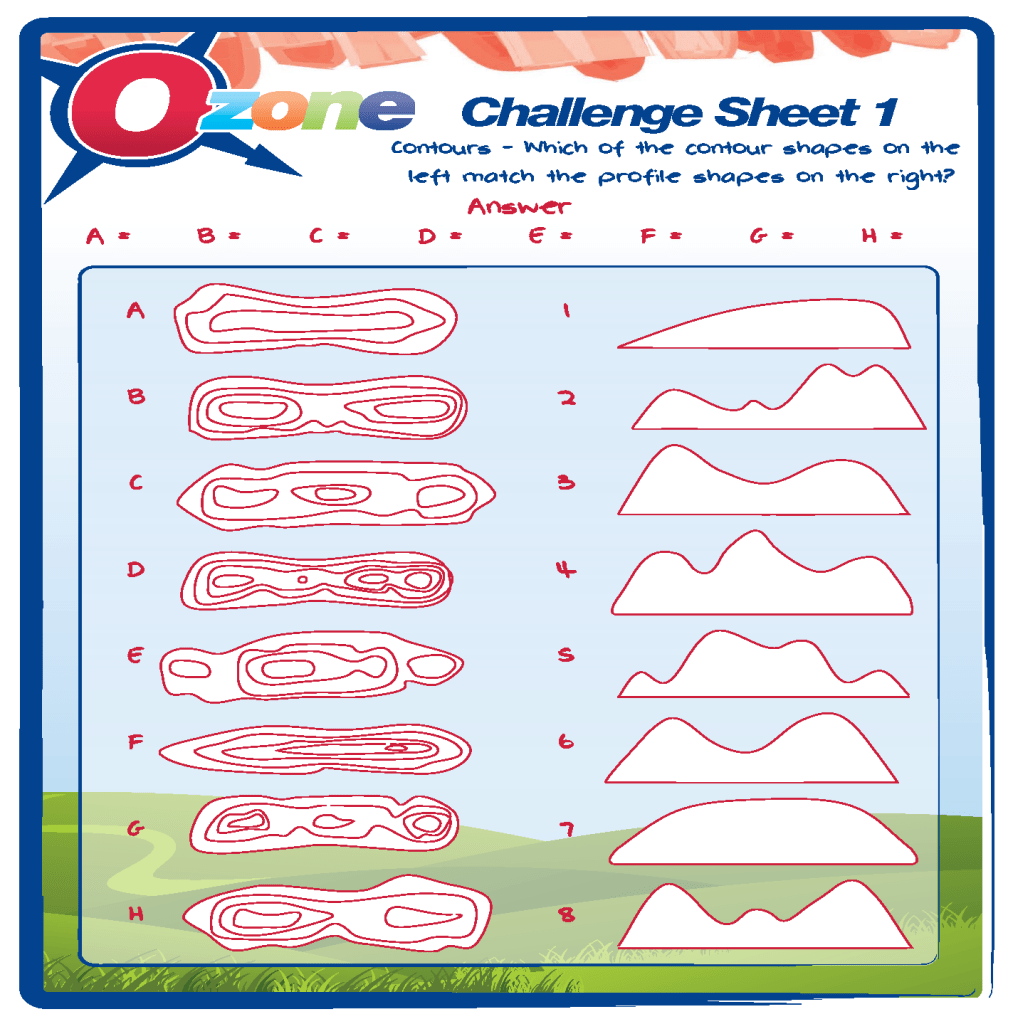
British Orienteering Ozone challenge sheets
These exercises are aimed at school level. There are 6 Challenge sheets to download:
https://www.britishorienteering.org.uk/page/challenges
Examples of the sheets:

Orienteering USA introduction
Orienteering USA How to orienteer skills pages give another good overview on the basics of how to orienteer
It can help to learn about the same skills from different sources, reading, watching videos etc. The extensive links in the Resources and Websites section can help you quickly find other material to compliment what you read and view on Better Orienteering.
.
Spend more time running with maps
There is no substitute for spending more time running with a map in hand navigating.
Open Orienteering Map UK offers the possibility to create a training map wherever you choose for use on streets and public parks. You are able to print out maps in a simplified Street map style and a “Pseudo-O” style. See under Maps for further details. You must read and respect the conditions of use set out there.

Don’t forget the web-linked Better Orienteering Summary
I suggest you download the Better Orienteering Summary to use alongside this website. It is a web-linked pdf that connects back to pages on Better Orienteering.

